Students can go through AP State Board 7th Class Social Studies Notes Chapter 1 Reading Maps of Different Kinds to understand and remember the concept easily.
AP State Board Syllabus 7th Class Social Studies Notes Chapter 1 Reading Maps of Different Kinds
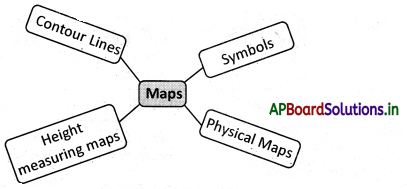
→ We use symbols to show any physical object on the map.
→ If we are asked to show Delhi on the India map, we will mark a point (●) and label it as Delhi.
→ All physical objects are shown on the map with the help of a point, line, or area symbol.
→ Physical maps show the variety of landforms (plains, mountains, plateaus, etc.) and depict the height of places.
→ One way in which we can show heights on maps is through the use of color.
→ All heights on the land are calculated from the seal level.
→ Heights are shown in different shades of colors.
→ A contour is a line joining the places with equal heights.
→ The distance between two contour lines will depend upon the landscape.
→ If the land has a steep climb then the contour lines will be near to each other.
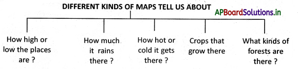
→ Maps help us to understand the nature of the terrain, where the mountains are, where the valleys are, etc.
![]()
→ Maps showing heights are very essential when roads or dams have to be constructed.
→ Over a period, scientists observed the high and low levels of the sea and they have come to one calculated average level, which is known as Mean Sea Level (M.S.L.)
→ Map: A map is a representation or a drawing of the total or a part of the earth’s surface drawn on the surface according to a scale.
→ Symbols: A sign, shape, or object which is used to represent something else.
→ Contour line: A contour is a line joining the places with equal heights.
→ Physical Maps: Maps showing natural features of the earth such as mountains, plateaus, plains, rivers, and oceans.
→ Scale: Scale is the ratio between an actual distance on the ground and the distance shown on the map.
→ Plan: It is a drawing of a small area on a large scale.
→ Corrections: There are four cardinal points – North, South, East, and West.
→ Sketch: Imaginary or rough drawing drawn without scale.
→ Political Maps: Maps showing cities, towns and villages and different countries and states of the world with their boundaries.
![]()
→ Thematic Maps: Maps representing a particular topic or theme.
→ Escarpment: An area of high ground from an area of lower ground is called escarpment.