Students can go through AP State Board 8th Class Social Studies Notes Chapter 1 Reading and Analysis of Maps to understand and remember the concept easily.
AP State Board Syllabus 8th Class Social Studies Notes Chapter 1 Reading and Analysis of Maps
→ A map is used by geographers to show features that we consider important.
→ Maps have a long history behind them.
→ The Sumerians, the Babylonians, the Greeks, the Arabs, and the Chinese prepared maps in the ancient period.
→ The science of map-making is Cartography.
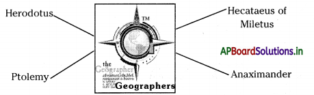
→ Al Idrisi, Ptolemy, Anaximander, Hecataeus of Miletus, and Herodotus were world-famous geographers and cartographers.
→ Gerardus Mercator devised a method for showing the correct shapes and directions of continents but with distortion of sizes and distances – Mercator’s projection.
→ The foundation of map-making in India was laid during the Vedic period.
→ Ancient Indian Scholars divided the known world into seven “wipes”.
→ Mahabharata conceived a round world surrounded by water.
→ The European colonial powers sent the scientific expeditions to the colonies with map makers.
→ Mt. Everest is named after Sir George Everest.
→ Maps were in great demand during times of war.
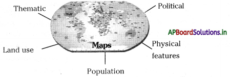
→ Maps were made and used for a variety of purposes.
![]()
→ Thematic maps focus on only one aspect.
→ We have to use different kinds of symbols, colors, and patterns to show everything related to that map.
→ The population can also be shown through shaded maps.
→ The symbols used by the map makers are known as conventional symbols.
→ Relief feature means the high and low places on the surface of the earth.
→ Contours are lines on a map joining places of the same height measured from the sea level. They are also called Isolines.
→ An atlas is a collection of maps.
→ Projection: A forecast based on present trends
→ Symbols: Things or persons that represent something else.
![]()
→ Geographer: The person who studies the physical features of the earth and of human activity as it relates to these
→ Contour: isolines — lines on a map joining places of the same height, measured from the sea level.
→ Cartography: The science of maps.
→ Survive: To continue to live or exist
→ Conquer: Overcome and take control of a place or its people by military force.
→ Destination: The place to which someone or something is going or being sent.
→ Depict: Represent by a drawing, painting, or other art forms.
→ Significance: Importance
→ Perspective: The art of representing solid objects on a flat surface so as to give the impression of height, width, depth, and relative distance.
→ Perspective: The art of representing solid objects on a flat surface so as to give the impression of height, width, depth, and relative distance.
→ Exploration: Travelling through an unfamiliar area in order to learn about it.
![]()
→ Enthusiasm: Great enjoyment, interest, or approval.
→ Maritime: Relating to shipping or other activity taking place at sea.
→ Curvature: The fact of being curved or the degree to which something is curved.
→ Distort: Pull or twist out of shape.
→ Impetus: The force or energy with which a body moves.
→ Indicate: Point out/Show.